Driving Directions to Barney's Kitchen in Seneca, Missouri
| GPS Coordinates |
|
36° 50.145 North
|
| 94° 36.628 West |
If driving via Joplin or Interstate 44:
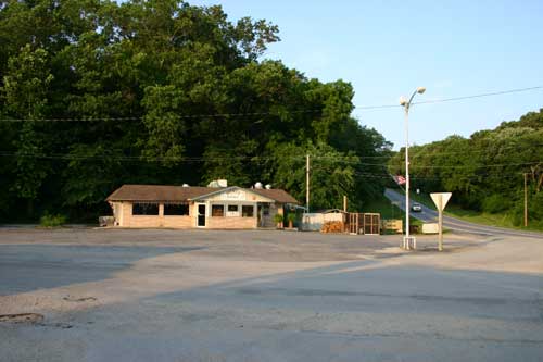
Proceed to Interstate 44 exit number 4, the Seneca exit. Take state highway 43 south to Seneca, about 12 miles. In Seneca, stay on 43 highway which is the "main street" of town. After crossing the railroad tracks, you will see a steep hill ahead. Barney's kitchen is located at the foot of the hill on the left.
If driving from Oklahoma via the Oklahoma Turnpike or US-60 highway:
If you are traveling the Oklahoma turnpike from Tulsa, exit at the Afton exit #302 onto US-60. Proceed eastward on US-60 to Seneca, about 19 miles.
After passing Wyandotte on US-60, just before you get to the Missouri line, you will find the Seneca turn-off to the left. This is business 60 which leads into town. When you get to the stop sign, Barney's is directly across the intersection.
If you miss the Seneca turnoff, don't worry. About a half mile after you cross the Missouri state line, turn north (left turn) onto state route 43 (at the blinker light). Follow 43 into town and you will soon go down a steep hill. Barney's is at the bottom of the hill on the right.
If driving from the north or south on US-71 or from the east on US-60:
If you are arriving via US-71 (the four lane highway), go to the Neosho, US-60 exit.
At Neosho, go west on US-60 for 11 miles to the state route 43 intersection. There is a blinker light at the intersection. Go north on 43 into town and you will soon go down a steep hill. Barney's is at the bottom of the hill on the right.
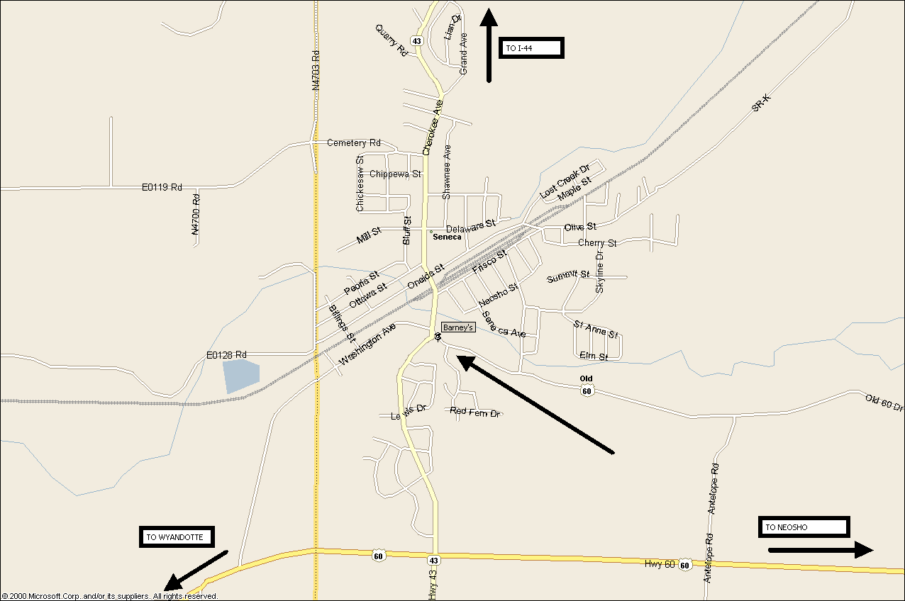
Map of Seneca, Missouri.
Click on the map to download a larger area map (1276 X 848 pixels) that shows the roads leading in/out of town. (Thanks to Steve, N5JPL for providing the map).
Back to Four State QRP Group home page
Updated July 9, 2004